Julius’s Ancestral Home
6
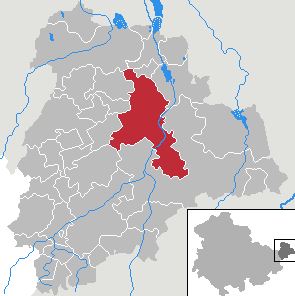
Altenburg is a city in Thuringia, Germany, located 40 kilometres (25 miles) south of Leipzig, 90 kilometres (56 miles) west of Dresden and 100 kilometres (62 miles) east of Erfurt. It is the capital of the Altenburger Land district and part of a polycentric old-industrial textile and metal production region between Gera, Zwickau and Chemnitz with more than 1 million inhabitants, while the city itself has a population of 33,000. Today, the city and its rural county is part of the Central German Metropolitan Region.
History
Altenburg was first mentioned in 976 and later became one of the first German cities within the former Slavic area, east of the Saale river (as part of the medieval Ostsiedlung movement). Emperor Frederick Barbarossa visited Altenburg several times between 1165 and 1188, hence the town is named a Barbarossa town today. Since the 17th century, Altenburg was the residence of different Ernestine duchies, of whom the Saxe-Altenburg persisted until the end of monarchy in Germany in 1918. Industrialization reached Altenburg and the region quite early in the first half of the 19th century and flourished until the Great Depression around 1930. Economic malaise set in while Altenburg was in East Germany and continued after German reunification in 1990, evidenced by a decline in population, high unemployment and house vacancy rates.
The main sights of Altenburg are the castle, the Lindenau-Museum, Rote Spitzen, the historic city center (most buildings are from early-modern origin) and the Gründerzeit architecture around the center. The popular German card game Skat was developed in Altenburg during the 1810s and the founder of the famous Brockhaus Enzyklopädie, Friedrich Arnold Brockhaus, lived and worked in Altenburg between 1810 and 1817.
Geography
Altenburg lies in the flat and fertile landscape of Osterland on the Pleiße river in the very east of Thuringia, next to the neighboring federal state of Saxony. Altenburg is bounded by Windischleuba, Nobitz, Saara, Altkirchen, Göhren, Lödla, Rositz, Wintersdorf and Gerstenberg.
History
The town (civitas Altenburg) was first mentioned in a deed to the bishop of Zeitz in 976. Remains of a Slavic castle on the Schloßberg demonstrate that the town was probably a Slavic foundation, the capital of the shire of Plisni, taken over during the conquest of Meißen by Henry I. As shown by place names, the surrounding area (Osterland) was mainly settled by Slavs.
The town’s location on the imperial road between Halle and Cheb in Bohemia gave Altenburg economic importance in the salt trade.
The first castle, located under the present day church St. Bartholomäi, was destroyed after the Battle of Hohenmölsen between Henry IV and Rudolph of Swabia. It was rebuilt on the Schloßberg outside of the town. The 11th century Mantelturm tower is still preserved. The castle later became an imperial palatinate and played an important part in the German takeover and settlement of the area between the Harz-mountains and the Elbe.
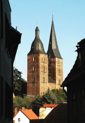
In the middle of the 12th century, the Hohenstaufen emperors patronized Altenburg, allowing the town to become a market and a mint. Together with the Royal forests Leina, Pahna, Kammerforst and Luckauer Forst, lands of the Groitzsch family bought by Frederick Barbarossa, Altenburg, Colditz, Zwickau and Chemnitz were turned into the Terra Plisniensis. Altenburg and Chemnitz as Imperial towns were intended to reduce the importance of Leipzig held by the Margrave of Meißen. Under Frederick Barbarossa much building took place, especially in the market area, and the town grew rapidly. An Augustine priory was founded and the church was finished in 1172. The twin towers (Rote Spitzen) are still preserved. A town wall was constructed at the end of the 12th century.
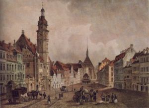
The etching below shows the Altenburg Market place as Julius Kirmse may have seen it in 1839.
![Altenburg Marketplace 1839. Source: Museum für saechsische Vaterlandskunde [Public domain], via Wikimedia Commons](https://pressbooks.pub/app/uploads/sites/4371/2022/10/Altenburg-Marketplace-1839_400.jpg)
The painting below shows the Altenburg Market place as Julius Kirmse would have seen it shortly before he emigrated to the USA in 1853.
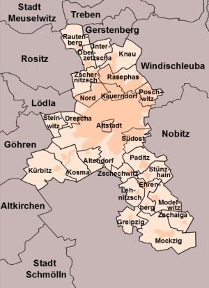
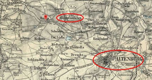
As is shown on the map below, Fichtenhainichen where Julius Kirmse grew up. is less than five miles northwest of Altenburg:
Information Source
This chapter was mostly abstracted from Wikipedia: Altenburg.
